This hike is part of the Adventure Report Ottawa Hiking Challenge. If you hike this trail, you’re officially working on the Starter Edition!
Join our Hiking Challenge Facebook Group to connect with other hikers working on the challenge, and don’t forget to tag us on social media so we can share your progress!
For sneak peeks of our (almost!) weekly blog posts or just to chat, follow us over on Instagram!
I’ve been avoiding the Sugarbush Trail in Gatineau Park for years. With it being kind of short, and so close to the visitor’s centre, I just didn’t think it would be that great. BUT, it’s one of the only trails available for walking (i.e., no snowshoes) in Gatineau Park in the winter. And the weather was so crazy in January with the thaw followed by a flash freeze, that we were looking for something easy on a Saturday and Sugarbush fit the bill. There were a few people out with their dogs, so it looks like this is one for the dog lovers! It can be tough to find good trails that you’re allowed to bring your dog on in the winter.
The Sugarbush Trail is open in the summer too, and would be great for younger kids any time of year.
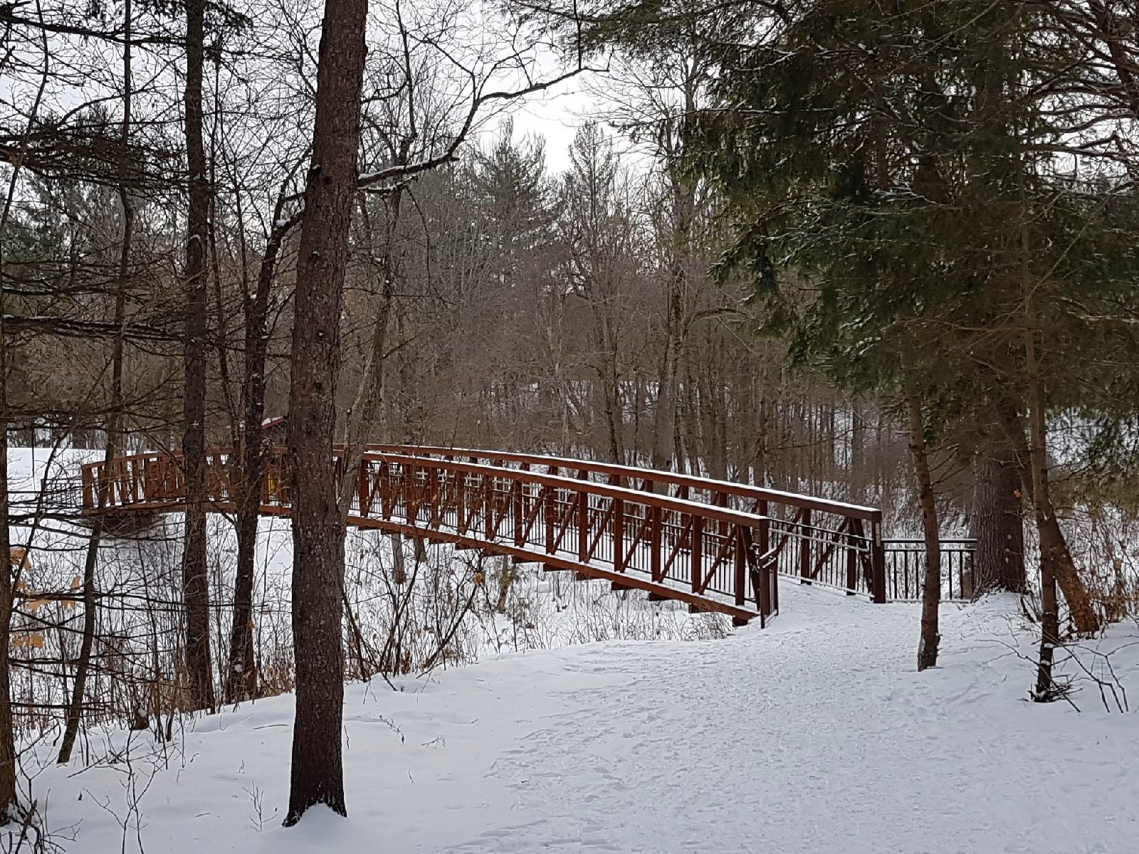
Bridge at the trail head for Sugarbush.

Getting There
To access this trail, we parked at the Gatineau Park Visitors Centre. The address there is 33 Chemin Scott, Chelsea, QC. Chelsea is a lovely area, and there are a handful of cute little restaurants, pubs, and cafes just across the street from the visitor’s centre.
Speaking of, the visitor’s centre is a great place to start your visit to Gatineau Park if you aren’t familiar with the area. They have maps of some of the different trails, and the people working there seemed like they knew the area really well.
They also rent snowshoes there. If you’re interested in snowshoeing but don’t want to invest a ton of money up front, that’s one way to check it out for a day or two before deciding if you want to buy your own. The cost of a rental (in 2018) was $9.00 for one hour, or $28.00 for the day. Kids’ snowshoes cost less!
There are (warm) washrooms inside the visitor’s centre, and an outhouse at the trail head. There are also nice big maps available inside and outside of the visitor’s centre.

The Route
To start the Sugarbush trail, we crossed over the red (rusty?) bridge that was to the south of the visitor’s centre. It was to the left when we were facing the centre.
After we had crossed the bridge and walked for 200 metres, there was a split in the trail. The Sugarbush Trail is a loop, and we chose to turn right, which had us completing it counter-clockwise.
We were in the forest immediately, and the path was nice and wide so we could walk side by side.

Skinny trees and a wide path on the Sugarbush Trail.

After hiking for 1 kilometre, we came across a sign announcing that there was a “rock shelter” only 130 metres away. We couldn’t bring ourselves to skip it, so we turned to our right to go check it out. The trail in this area was not as wide, and we traveled single file. Gatineau Park was playing pretty fast and loose with the word “shelter” here, but it was still kind of neat to see.

The Rock Shelter just off the Sugarbush Trail.
We carried on to connect back to the Sugarbush Trail, and after hiking for only 1.2 kilometres we had another decision to make. The trail split, and gave us the choice to stick with the Sugarbush Trail, or make a detour onto Trail 13. We chose to turn right onto Trail 13, and walked .6 kilometres out to Parking Lot #8 (where there’s another big map). Dogs are not allowed on Trail 13, so that’s something to keep in mind if you’re visiting with your pup!
Taking this route allowed us to add on an additional 1.2 kilometres to the trip, because Trail 13 is an out-and-back. It’s also a little bit hilly, so on the way back we warmed up going uphill!
When we had walked back to the Sugarbush Trail, we turned right to complete the loop. From this point, we walked .6 kilometres back to where we had started.
Alternate Route Options
We could have chosen to complete the Sugarbush Trail on its own, if we were looking for a shorter route. If we hadn’t taken Trail 13, the total length of the Sugarbush Trail alone would have been 1.9 kilometres.
Parking at P8 and starting on Trail 13 would also be a good option, if you didn’t want to bring a pup with you. You can use these coordinates to get there: 45.509753, -75.824342.

Trail 13 is definitely worth adding on (in my opinion).
We were able to complete the Sugarbush Trail and Trail 13 (a total of 3.1 kilometres) in 45 minutes. The trail really wasn’t very demanding in terms of elevation gain. It was absolutely perfect on a day where trail conditions on the longer trails might have made things too challenging. It would also be fantastic for families with dogs, young children, or people who are just starting to get out and about during winter.
I hope this trip report has enough info to get you there too. Let me know in the comments, or share and tag a friend to start planning your next adventure!
Map and Elevation Gain

Our map of the Sugarbush Trail and Trail 13.

Elevation gain on the Sugarbush Trail and Trail 13 (next to none).

Part of the NCC’s Gatineau Park Winter Map.
Gear We Brought
- Winter boots
- Base layers
- Fleece sweater
- Winter Jacket
- Snow Pants
- Mittens
- Buff Merino Wool Headband
- Wool hat
- Sunglasses
